This natural environment is made up of quartzite and slate rocks dating back to 500 million years ago on the shores of the Southern Hemisphere. They underwent drastic transformations, and even used to belong to a large mountain range of comparable height to the current Himalaya, as a result of the collision of two supercontinents, Laurussia and Gondwana, 350 million years ago.
This rocky base has been subject to tectonic shifts, successive flood stages and sea withdrawals, as well as erosion by terrestrial agents, giving rise to the unique plains that skirt the Cantabric sea today. These plains are known as rasa costera, and stretch from Burela to San Vicente de la Barquera.
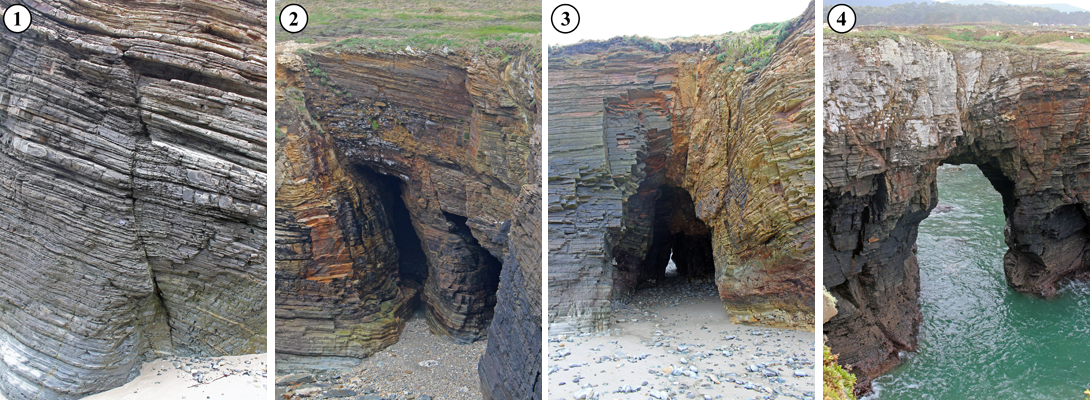
We owe the existence of this one-of-a-kind natural monument to a combination of the cracks in rock strata and their orientation, which makes them particulaly susceptible to the constant pounding waves. These forces gave the cliffs their peculiar shape. The timeline of this stretch of coast comprises the following four stages:

The first stage (1) is where coastal erosion was most intense, as shown by the cracks in the rocks.
The second stage (2) is when the caves or grottos were formed, following the orientation of the cracks in the rocks.
In the third stage (3), the caves connected with each other, and a series of holes, called “ollos” (eyes) by the locals, were formed as a consequence of the terrain over the caves collapsing.
Finally, the fourth stage (4) is when the rocky arches were formed. Due to their fragility and instability against coastal erosion, only a few remain, especially in the areas with resistant rocky strata.
